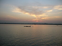
| Naf River | |
|---|---|
 | |
 | |
| Location | |
| Country | Bangladesh and Myanmar |
| Physical characteristics | |
| Mouth | |
• location | Bay of Bengal |
• coordinates | 20°43′N 92°22′E / 20.717°N 92.367°E |
| Depth | |
| • average | 128 feet (39 m) |
| • maximum | 400 feet (120 m) |

The Naf River (Bengali: নাফ নদী Naf Nodi IPA: [naf nod̪i]; Burmese: နတ်မြစ် [naʔ mjɪʔ]; Rakhine: နတ်မြစ် [nɛ́ mràɪʔ]) is an international river marking the border of southeastern Bangladesh and northwestern Myanmar.[1]
- ^ Sifatul Quader Chowdhury (2012), "Naf River", in Sirajul Islam and Ahmed A. Jamal (ed.), Banglapedia: National Encyclopedia of Bangladesh (Second ed.), Asiatic Society of Bangladesh