Nafpaktos
Ναύπακτος | |
|---|---|
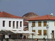
Clockwise from top right: Old Port of Naupactus, Nafpaktos' Port Fortifications, Old Houses with Fethiye Mosque in the back, Botsaris Tower Museum, Giorgos Anemogiannis Statue in the Port Fortifications, Miguel de Cervantes Statue, Venetian Fortress of Lepanto | |
| Coordinates: 38°23′38″N 21°49′50″E / 38.39389°N 21.83056°E | |
| Country | Greece |
| Administrative region | West Greece |
| Regional unit | Aetolia-Akarnania |
| Municipality | Nafpaktia |
| Area | |
| • Municipal unit | 159.9 km2 (61.7 sq mi) |
| Highest elevation | 15 m (49 ft) |
| Lowest elevation | 0 m (0 ft) |
| Population (2021)[1] | |
| • Municipal unit | 17,154 |
| • Municipal unit density | 110/km2 (280/sq mi) |
| • Community | 12,950 |
| Time zone | UTC+2 (EET) |
| • Summer (DST) | UTC+3 (EEST) |
| Postal code | 303 00 |
| Area code(s) | 26340 |
| Vehicle registration | ME |
| Website | www |
Nafpaktos (Greek: Ναύπακτος) or Naupactus, is a town and a former municipality in Nafpaktia, Aetolia-Acarnania, West Greece, situated on a bay on the north coast of the Gulf of Corinth, 3 km (2 mi) west of the mouth of the river Mornos.
It is named for Naupaktos (Ναύπακτος, Latinized as Naupactus), an important Athenian naval station in the Peloponnesian war. As a strategically crucial possession controlling access to the Gulf of Corinth, Naupaktos changed hands many times during the Crusades and the Ottoman–Venetian Wars. It was under Venetian control in the 15th century, and came to be known by the Venetian form of its name, Lepanto. It fell to the Ottoman Empire in 1499 and was used as a naval station by the Ottoman Navy in the 16th century, being the site of the decisive victory by the Holy League in the Battle of Lepanto in 1571. Except for a brief period of Venetian control in 1687–1699, Lepanto remained under Ottoman control until Greek independence in 1829.
The modern municipality was incorporated in 1946, and later merged into the larger Nafpaktia municipality in the 2010 reform. Nafpaktos is now both the name of a municipal unit within Nafpaktia and of the town proper within the Nafpaktos unit.[2] The municipal district has an area of 159,947 square kilometres (61,756 square miles), with a population close to 20,000 as of 2011[update].[3]
The town is 9 km (6 mi) northeast of Antirrio, 18 km (11 mi) northeast of Patras, 35 km (22 mi) east of Missolonghi and 45 km (28 mi) southeast of Agrinio. The Greek National Road 48/E65 (Antirrio – Nafpaktos – Delphi – Livadeia) passes north of the town. It is the second largest town of Aetolia-Acarnania, after Agrinio.
- ^ "Αποτελέσματα Απογραφής Πληθυσμού - Κατοικιών 2021, Μόνιμος Πληθυσμός κατά οικισμό" [Results of the 2021 Population - Housing Census, Permanent population by settlement] (in Greek). Hellenic Statistical Authority. 29 March 2024.
- ^ "ΦΕΚ B 1292/2010, Kallikratis reform municipalities" (in Greek). Government Gazette.
- ^ "Population & housing census 2001 (incl. area and average elevation)" (PDF) (in Greek). National Statistical Service of Greece.


