| Nagold | |
|---|---|
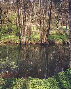
 The Nagold in its middle reaches between Nagold and Calw | |
 | |
| Location | |
| Country | Germany |
| State | Baden-Württemberg |
| Physical characteristics | |
| Source | |
| • location | Urnagold |
| • coordinates | 48°36′18″N 8°26′12.5″E / 48.60500°N 8.436806°E |
| • elevation | 814 m (2,671 ft) |
| Mouth | |
• location | Enz in Pforzheim |
• coordinates | 48°53′19″N 8°42′16″E / 48.88861°N 8.70444°E |
• elevation | 247 m (810 ft) |
| Length | 90.8 km (56.4 mi) [1] |
| Basin size | 1,144 km2 (442 sq mi) [1] [3] |
| Discharge | |
| • average | Calw: lowest ever: 1.17 m3/s (41 cu ft/s) (2003), lowest average: 2.0 m3/s (71 cu ft/s), average: 7.82 m3/s (276 cu ft/s)[2] |
| Basin features | |
| Progression | Enz→ Neckar→ Rhine→ North Sea |
| Tributaries | |
| • left | Teinach |
| • right | Waldach, Würm |
The Nagold is a river in Baden-Württemberg, southwestern Germany. A tributary of the Enz,[4] it gave its name to the town of Nagold. It merges with the smaller Enz in the town centre of Pforzheim.
- ^ a b Map services of the Baden-Württemberg State Office for the Environment, Survey and Conservation (Landesanstalt für Umwelt, Messungen und Naturschutz Baden-Württemberg)
- ^ The increase below the Unterreichenbach Gauge is calculated by determining the catchment between the gauges of Unterreichenbach (Nagold), Rotenbach (Eyach), Höfen (Enz), Pforzheim (Würm) and Pforzheim (Enz). The gauge values are available at [1] Archived 2014-01-12 at the Wayback Machine (pdf; 1.1 MB) and [2]. Differences are noted.
- ^ Ministry for the Environment Climate and Energy Use, Baden-Württemberg: Ausbaupotenzial der Wasserkraft bis 1.000 KW im Einzugsgebiet des Neckars unter Berücksichtigung ökologischer Bewirtschaftungsziele Archived 2013-10-29 at the Wayback Machine, 2011, p.9, retrieved 29 June 2013 (pdf, German, 1.87 MB)
- ^ Johnston, Alexander Keith (1868). Dictionary of geography: descriptive, physical, statistical, and historical, forming a complete gazetteer of the world. Longmans, Green, Reader, and Dyer. p. 874. Retrieved 7 September 2011.