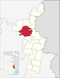
Nakashipara | |
|---|---|
Community development block | |
 | |
| Coordinates: 23°35′N 88°21′E / 23.58°N 88.35°E | |
| Country | |
| State | West Bengal |
| District | Nadia |
| Government | |
| • Type | Community development block |
| Area | |
| • Total | 360.94 km2 (139.36 sq mi) |
| Elevation | 13 m (43 ft) |
| Population (2011) | |
| • Total | 386,569 |
| • Density | 1,100/km2 (2,800/sq mi) |
| Languages | |
| • Official | Bengali, English |
| Literacy (2011) | |
| • Total literates | 220,021 (64,86%) |
| Time zone | UTC+5:30 (IST) |
| PIN | 741126 (Khidirpur Bethuadahari) 741154 (Muragachha) 741185 (Dogachhi) |
| Telephone/STD code | 03474 |
| Vehicle registration | WB-51, WB-52 |
| Lok Sabha constituency | Krishnanagar |
| Vidhan Sabha constituency | Nakashipara, Palashipara |
| Website | nadia |
Nakashipara is a community development block that forms an administrative division in Krishnanagar Sadar subdivision of Nadia district in the Indian state of West Bengal.