Namborn | |
|---|---|
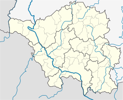
Location of Namborn within Sankt Wendel district  | |
| Coordinates: 49°31′N 7°8′E / 49.517°N 7.133°E | |
| Country | Germany |
| State | Saarland |
| District | Sankt Wendel |
| Subdivisions | 8 |
| Government | |
| • Mayor (2018–28) | Sascha Hilpüsch[1] (Ind.) |
| Area | |
| • Total | 26.00 km2 (10.04 sq mi) |
| Highest elevation | 509 m (1,670 ft) |
| Lowest elevation | 288 m (945 ft) |
| Population (2022-12-31)[2] | |
| • Total | 6,939 |
| • Density | 270/km2 (690/sq mi) |
| Time zone | UTC+01:00 (CET) |
| • Summer (DST) | UTC+02:00 (CEST) |
| Postal codes | 66640 |
| Dialling codes | 06857 (Namborn: 06854, Baltersweiler: 06851) |
| Vehicle registration | WND |
| Website | www.namborn.de |
Namborn is a municipality in the district of Sankt Wendel, in Saarland, Germany. It is situated approximately 7 km north of Sankt Wendel, and 25 km southwest of Idar-Oberstein. It is approximately 40 km northeast of Saarbrücken on highway B 41 and the Nahe Valley Railway line. The distance to the Bostalsee is about 10 km, and to the county seat St. Wendel about 7 km.

The most famous landmark of the community is the ruins of Liebenburg Castle on the Schloßberg in the Eisweiler district.
The administrative center is located in the Hofeld-Mauschbach district because of its convenient transport links and central location.
- ^ Gewählte Ober-/Bürgermeister*innen, Landrät*innen und Regionalverbandsdirektor*in im Saarland, Statistisches Amt des Saarlandes, 27 March 2022.
- ^ "Fläche und Bevölkerung - Stand: 31.12.2022 (Basis Zensus 2011)" (PDF) (in German). Statistisches Amt des Saarlandes. June 2023.


