This article needs additional citations for verification. (February 2008) |
| Nandewar Range | |
|---|---|
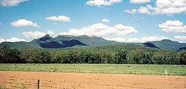
 Mount Kaputar, the third peak from the left, is the range's highest peak. | |
| Highest point | |
| Peak | Mount Kaputar |
| Elevation | 1,508 m (4,948 ft) |
| Geography | |
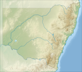
Location in New South Wales | |
| Country | Australia |
| State | New South Wales |
| Range coordinates | 30°30′S 151°00′E / 30.5°S 151°E |
| Geology | |
| Rock age | Cenozoic |
| Rock type | Shield volcano |
The Nandewar Range, a mountain range that is part of the Great Dividing Range, is located in the North West Slopes region of New South Wales, Australia. The range is situated approximately 30 km (19 mi) east of the township of Narrabri.
John Oxley was the first European to see the range in 1818 as he explored the New South Wales.[1]
- ^ Oxley, John (2014). "Journal of an Expedition in Australia — Part II". Journals of Two Expeditions into the Interior of New South Wales, by order of the British Government in the years 1817-18. The University of Adelaide. Archived from the original (ebook) on July 15, 2011. Retrieved 27 May 2015.
