 NASA picture of Napuka Atoll | |
| Geography | |
|---|---|
| Location | Pacific Ocean |
| Coordinates | 14°10′12″S 141°13′52″W / 14.17000°S 141.23111°W |
| Archipelago | Tuamotus |
| Area | 18 km2 (6.9 sq mi) (lagoon) 8 km2 (3 sq mi) (above water) |
| Length | 10.5 km (6.52 mi) |
| Width | 4 km (2.5 mi) |
| Administration | |
France | |
| Overseas collectivity | French Polynesia |
| Administrative subdivision | Îles Tuamotu-Gambier |
| Commune | Napuka |
| Largest settlement | Tepukamaruia |
| Demographics | |
| Population | 255[1] (2022) |
Napuka | |
|---|---|
 | |
 | |
| Coordinates: 14°10′12″S 141°13′52″W / 14.17011°S 141.23106°W | |
| Country | France |
| Overseas collectivity | French Polynesia |
| Subdivision | Îles Tuamotu-Gambier |
| Area 1 | 1 km2 (0.4 sq mi) |
| Population (2022)[1] | 307 |
| • Density | 310/km2 (800/sq mi) |
| Time zone | UTC−10:00 |
| INSEE/Postal code | 98730 / |
| Elevation | 0 m (0 ft) |
| 1 French Land Register data, which excludes lakes, ponds, glaciers > 1 km2 (0.386 sq mi or 247 acres) and river estuaries. | |
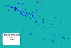
Napuka, or Pukaroa, is a small coral atoll in the Disappointment Islands, in the northeastern part of the Tuamotu Archipelago in French Polynesia. It is located only 15 km to the southeast of Tepoto Nord, its nearest neighbor, forming a small group. These two atolls are quite isolated, the nearest land being Fangatau Atoll 170 km to the south.
Napuka Atoll is 10.5 km long and about 4 km wide. Its reef is quite broad, completely enclosing the lagoon. The total dry land area of the thirty islands on Napuka's reef is 8 km2. The surface of the lagoon is 18 km2.
Napuka has 255 inhabitants according to the 2022 census.[1] The main village is Tepukamaruia (Te Puka Maru Ia).
- ^ a b c "Les résultats du recensement de la population 2022 de Polynésie française" [Results of the 2022 population census of French Polynesia] (PDF) (in French). Institut de la statistique de la Polynésie française. January 2023.

