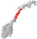
Narvik Municipality
Narvik kommune | |
|---|---|
 View of Narvik | |
| Nicknames: By1 | |
 Nordland within Norway | |
 Narvik within Nordland | |
| Coordinates: 68°25′14″N 17°33′36″E / 68.42056°N 17.56000°E | |
| Country | Norway |
| County | Nordland |
| District | Ofoten |
| Established | 1 Jan 1902 |
| • Preceded by | Ankenes Municipality |
| Administrative centre | Narvik |
| Government | |
| • Mayor (2015) | Rune Edvardsen (Ap) |
| Area | |
| • Total | 3,432.20 km2 (1,325.18 sq mi) |
| • Land | 3,194.70 km2 (1,233.48 sq mi) |
| • Water | 237.50 km2 (91.70 sq mi) 6.9% |
| • Rank | #10 in Norway |
| Highest elevation | 1,893.7 m (6,212.9 ft) |
| Population (2024) | |
| • Total | 21,580 |
| • Rank | #61 in Norway |
| • Density | 6.3/km2 (16/sq mi) |
| • Change (10 years) | |
| Demonyms | Narvikværing Narviking[2] |
| Official language | |
| • Norwegian form | Neutral |
| Time zone | UTC+01:00 (CET) |
| • Summer (DST) | UTC+02:00 (CEST) |
| ISO 3166 code | NO-1806[4] |
| Website | Official website |
(Northern Sami: Áhkanjárga[5]) is the third-largest municipality in Nordland county, Norway, by population. The administrative centre of the municipality is the town of Narvik. Some of the notable villages in the municipality include Ankenesstrand, Ballangen, Beisfjord, Bjerkvik, Bjørnfjell, Elvegården, Kjøpsvik, Skjomen, Håkvik, Hergot, Straumsnes, and Vidrek. The Elvegårdsmoen army camp is located near Bjerkvik.
Narvik is located on the shores of the Ofotfjorden. The municipality is part of the traditional district of Ofoten of Northern Norway, inside the Arctic Circle. Narvik Municipality borders Hamarøy Municipality to the southwest; Evenes Municipality to the northwest; Bardu Municipality, Gratangen Municipality, Lavangen Municipality, and Tjeldsund Municipality (in Troms county) to the north; and Norrbotten County (Lapland) in Sweden to the south and east.
The 3,432-square-kilometre (1,325 sq mi) municipality is the 10th largest by area out of the 357 municipalities in Norway. Narvik is the 61st most populous municipality in Norway with a population of 21,580. The municipality's population density is 6.3 inhabitants per square kilometre (16/sq mi) and its population has increased by 15.4% over the previous 10-year period.[6][7]
- ^ "Høgaste fjelltopp i kvar kommune" (in Norwegian). Kartverket. 16 January 2024.
- ^ "Navn på steder og personer: Innbyggjarnamn" (in Norwegian). Språkrådet.
- ^ "Forskrift om målvedtak i kommunar og fylkeskommunar" (in Norwegian). Lovdata.no.
- ^ Bolstad, Erik; Thorsnæs, Geir, eds. (26 January 2023). "Kommunenummer". Store norske leksikon (in Norwegian). Kunnskapsforlaget.
- ^ Schanche, Tor Emil (22 September 2016). "Nå er denne byen endelig formelt "døpt" med et samisk navn". NRK Sápmi (in Norwegian). Archived from the original on 23 September 2016. Retrieved 19 September 2017.
- ^ Statistisk sentralbyrå (2020). "Table: 06913: Population 1 January and population changes during the calendar year (M)" (in Norwegian). Archived from the original on 26 May 2020. Retrieved 10 January 2019.
- ^ Statistisk sentralbyrå (2020). "09280: Area of land and fresh water (km2) (M)" (in Norwegian). Archived from the original on 26 May 2020. Retrieved 10 January 2019.

