This article needs additional citations for verification. (January 2013) |
Nasiriyah Airport | |||||||||||||||
|---|---|---|---|---|---|---|---|---|---|---|---|---|---|---|---|
 An Ilyushin Il-76 cargo aircraft at the base in 2007 | |||||||||||||||
| Summary | |||||||||||||||
| Airport type | Public / Military | ||||||||||||||
| Operator | Iraqi Airways / Iraqi Air Force | ||||||||||||||
| Serves | Nasiriyah | ||||||||||||||
| Hub for | Iraqi Airways | ||||||||||||||
| Elevation AMSL | 20 ft / 6 m | ||||||||||||||
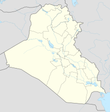
| Coordinates | 30°56′23″N 046°05′33″E / 30.93972°N 46.09250°E | ||||||||||||||
| Map | |||||||||||||||
 | |||||||||||||||
| Runways | |||||||||||||||
| |||||||||||||||
no ILS | |||||||||||||||
Nasiriyah Airport (IATA: XNH, ICAO: ORTL) is a public and military airport[1] located 23 km (14 mi) southwest of Nasiriyah, Iraq.
It is also known as Tallil Air Base until December 2011 and Imam Ali Air Base until March 2017, when the base was used by United States Armed Forces. It is generally known as Camp Adder by the U.S. Army; the name Ali Air Base is used chiefly by the U.S. Air Force; the installation, however, is still commonly referred to as "Tallil".[2]

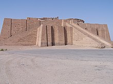
The base occupies 30 km2 (11.6 sq mi) and is protected by 22 km (13.7 mi) of security perimeter. The ancient Babylonian city of Ur, one of the places identified as Ur of the Chaldees, the birthplace of Abraham, is located within the security perimeter of Ali Base, and its ancient ziggurat is visible from nearly every corner of the base.[3]
- ^ "Iraq says Nasiriyah airport infrastructure ready". Emirates 247. 10 December 2014. Retrieved 1 April 2020.
- ^ "Tallil Airbase".
- ^ "Recovered Treasures of Nimrud".
