Navajo County | |
|---|---|
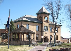
 Historic Navajo County Courthouse and Museum in Holbrook | |
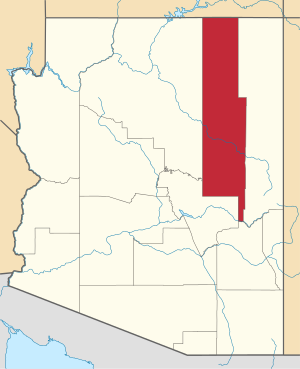
 Location within the U.S. state of Arizona | |
 Arizona's location within the U.S. | |
| Coordinates: 35°29′52″N 110°17′23″W / 35.4978°N 110.2897°W | |
| Country | |
| State | |
| Founded | March 21, 1895 |
| Named for | Navajo Nation |
| Seat | Holbrook |
| Largest city | Show Low |
| Area | |
| • Total | 9,960 sq mi (25,800 km2) |
| • Land | 9,950 sq mi (25,800 km2) |
| • Water | 9.3 sq mi (24 km2) 0.09% |
| Population (2020) | |
| • Total | 106,717 |
| • Estimate (2023) | 109,175 |
| • Density | 11/sq mi (4.1/km2) |
| Time zone | UTC−7 (Mountain) |
| Congressional district | 2nd |
| Website | www |
Navajo County (Navajo: Tʼiisyaakin Áłtsʼíísí Bił Hahoodzo) is a county in the northern part of the U.S. state of Arizona. As of the 2020 census, its population was 106,717.[1] The county seat is Holbrook.[2]
Navajo County comprises the Show Low, Arizona Micropolitan Statistical Area.
Navajo County contains parts of the Hopi Indian reservation, the Navajo Nation, and Fort Apache Indian Reservation.
- ^ "State & County QuickFacts". United States Census Bureau. Retrieved September 27, 2022.
- ^ "Find a County". National Association of Counties. Retrieved June 7, 2011.
