| Navajo Mountain | |
|---|---|
| Navajo: Naatsisʼáán | |
 Navajo Mountain and Lake Powell, looking southeast from the Kaiparowits Plateau | |
| Highest point | |
| Elevation | 10,348 ft (3,154 m) NAVD 88[1] |
| Prominence | 4,226 ft (1,288 m)[2] |
| Listing | Mountain peaks of Utah |
| Coordinates | 37°02′03″N 110°52′10″W / 37.034253908°N 110.869576753°W[1] |
| Geography | |
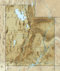
| Location | |
| Topo map | USGS Navajo Begay |
| Geology | |
| Mountain type | Laccolith |
| Climbing | |
| Easiest route | Radio Towers Road |
Navajo Mountain (Navajo: Naatsisʼáán meaning "Earth Head"[3]) is a peak in San Juan County, Utah, with its southern flank extending into Coconino County, Arizona, in the United States.[4] It holds an important place in the traditions of three local Native American tribes. The summit is the highest point on the Navajo Nation.[2]
- ^ a b "San Juan". NGS Data Sheet. National Geodetic Survey, National Oceanic and Atmospheric Administration, United States Department of Commerce. Retrieved 2014-02-08.
- ^ a b "Navajo Mountain, Utah". Peakbagger.com. Retrieved 2014-02-08.
- ^ Yurth, Cindy (October 17, 2013). "A good place to hide". Navajo Times.
- ^ U.S. Geological Survey Geographic Names Information System: Navajo Mountain

