This article needs additional citations for verification. (May 2016) |
Nayarambalam | |
|---|---|
suburb | |
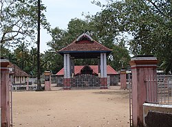
 Nayarambalam Bhagavathy Temple | |
 | |
| Coordinates: 10°04′16″N 76°12′43″E / 10.071°N 76.212°E | |
| Country | |
| State | Kerala |
| District | Ernakulam district |
| Government | |
| • Panchayath President | Mrs. Shibu E P |
| Area | |
| • Total | 12.19 km2 (4.71 sq mi) |
| Elevation | 2.83 m (9.28 ft) |
| Population (2001) | |
| • Total | 23,166 |
| • Density | 1,783/km2 (4,620/sq mi) |
| Languages | |
| • Official | Malayalam, English |
| Time zone | UTC+5:30 (IST) |
| PIN | 682509 |
| Telephone code | 0484 |
| Temperature Range: 22 °C – 31 °C | |
Nayarambalam is a suburb of Kochi city and coastal village on Vypin island in the state of Kerala, India.
The village is surrounded by Edavanakkad Gram panchayat to the north, Narakkal Gram Panchayat to the south, the Arabian Sea to the west and Veeranpuzha to the east. Nayarambalam lies almost at the center of Vypin Island. Agriculture and fishing were traditionally the main sources of income for the people, but now most of the people depend on Kochi city, the nearest city on the mainland. There are still many paddy fields and fish ponds especially in the eastern and western areas of the village.