Nesna Municipality
Nesna kommune | |
|---|---|
| Nesne herred (historic name) | |
 | |
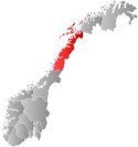
 Nordland within Norway | |
 Nesna within Nordland | |
| Coordinates: 66°15′28″N 13°02′06″E / 66.25778°N 13.03500°E | |
| Country | Norway |
| County | Nordland |
| District | Helgeland |
| Established | 1 January 1838 |
| • Created as | Formannskapsdistrikt |
| Administrative centre | Nesna |
| Government | |
| • Mayor (2015) | Hanne Davidsen (Ap) |
| Area | |
| • Total | 183.19 km2 (70.73 sq mi) |
| • Land | 181.30 km2 (70.00 sq mi) |
| • Water | 1.89 km2 (0.73 sq mi) 1% |
| • Rank | #310 in Norway |
| Highest elevation | 921.75 m (3,024.11 ft) |
| Population (2024) | |
| • Total | 1,808 |
| • Rank | #294 in Norway |
| • Density | 9.9/km2 (26/sq mi) |
| • Change (10 years) | |
| Demonym | Nesnaværing[2] |
| Official language | |
| • Norwegian form | Bokmål |
| Time zone | UTC+01:00 (CET) |
| • Summer (DST) | UTC+02:00 (CEST) |
| ISO 3166 code | NO-1828[4] |
| Website | Official website |
Nesna is a municipality in Nordland county, Norway. It is part of the Helgeland traditional region. The administrative centre of the municipality is the village of Nesna. Other villages in Nesna include Handnesneset, Husby, Saura, and Vikholmen.

The municipality consists of the three main islands Tomma, Hugla (known as "Hugløy" by its inhabitants), and Handnesøya, and one peninsula that bears the name of the municipality, Nesna. The old Husby Estate is headquartered in Husby on Tomma island.
The Coastal Express arrives two times a day at the village of Nesna, the northbound arrives 05:30 and the southbound 11:15. The village of Nesna is also home to the Nesna campus of Nord University, and there is also the KVN High School, and Nesna Church.
The 183.2-square-kilometre (70.7 sq mi) municipality is the 310th largest by area out of the 357 municipalities in Norway. Nesna is the 294th most populous municipality in Norway with a population of 1,808. The municipality's population density is 9.9 inhabitants per square kilometre (26/sq mi) and its population has decreased by 4.9% over the previous 10-year period.[5][6]
- ^ "Høgaste fjelltopp i kvar kommune" (in Norwegian). Kartverket. 16 January 2024.
- ^ "Navn på steder og personer: Innbyggjarnamn" (in Norwegian). Språkrådet.
- ^ "Forskrift om målvedtak i kommunar og fylkeskommunar" (in Norwegian). Lovdata.no.
- ^ Bolstad, Erik; Thorsnæs, Geir, eds. (26 January 2023). "Kommunenummer". Store norske leksikon (in Norwegian). Kunnskapsforlaget.
- ^ Statistisk sentralbyrå. "Table: 06913: Population 1 January and population changes during the calendar year (M)" (in Norwegian).
- ^ Statistisk sentralbyrå. "09280: Area of land and fresh water (km²) (M)" (in Norwegian).

