| Netherlee | |
|---|---|
 Ormonde Crescent, with a view towards Glasgow and the Campsie Fells in the distance | |
| Population | 4,530 (2022)[1] |
| OS grid reference | NS575585 |
| • Edinburgh | 43 mi (69 km) ENE |
| • London | 342 mi (550 km) SSE |
| Community council |
|
| Council area | |
| Lieutenancy area | |
| Country | Scotland |
| Sovereign state | United Kingdom |
| Post town | GLASGOW |
| Postcode district | G44 |
| Dialling code | 0141 |
| Police | Scotland |
| Fire | Scottish |
| Ambulance | Scottish |
| UK Parliament | |
| Scottish Parliament | |
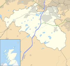
Netherlee is a suburban residential area in East Renfrewshire, Scotland. It is situated on the west bank of the White Cart Water about 4 miles (6.5 km) south of Glasgow city centre. Part of the Greater Glasgow conurbation, it is mostly contiguous with the city, and is just beyond the boundary of its local authority area. It is a separate census locality from Glasgow, like other areas such as neighbouring Giffnock and Clarkston. Netherlee is directly contiguous with Stamperland. It is also in a council ward with Clarkston and its neighbour Busby. As of 2012, Netherlee has a population of 4,550.
Originally a small rural hamlet dependent upon the mills along the river, Netherlee became extensively urbanised in the 20th century, developing into an affluent commuter suburb. The area is served by a parish church, primary school and library, as well as a number of local shops and parks. Cathcart Cemetery also falls within the boundaries of Netherlee.
- ^ "Mid-2020 Population Estimates for Settlements and Localities in Scotland". National Records of Scotland. 31 March 2022. Retrieved 31 March 2022.

