| New Waddell Dam | |
|---|---|
 | |
| Country | United States |
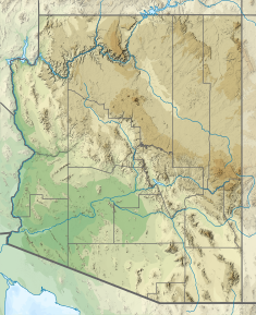
| Location | Maricopa County, Arizona |
| Coordinates | 33°50′49″N 112°15′58″W / 33.84694°N 112.26611°W |
| Purpose | Irrigation, power |
| Status | Operational |
| Construction began | 1985 |
| Opening date | 1994 |
| Construction cost | $625 million |
| Owner(s) | U.S. Bureau of Reclamation |
| Operator(s) | Central Arizona Project |
| Dam and spillways | |
| Type of dam | Embankment, zoned earth-fill |
| Impounds | Agua Fria River |
| Height (foundation) | 440 ft (130 m) |
| Height (thalweg) | 300 ft (91 m) |
| Length | 4,700 ft (1,400 m) |
| Width (crest) | 35 ft (11 m) |
| Width (base) | 1,514 ft (461 m) |
| Dam volume | 16,200,000 cu yd (12,400,000 m3) |
| Spillways | 2 |
| Spillway type | Un-gated, free-flow, Fuse plug embankment |
| Spillway capacity | 316,000 cu ft/s (8,900 m3/s) (combined; at elevation) |
| Reservoir | |
| Creates | Lake Pleasant |
| Total capacity | 1,108,600 acre⋅ft (1.3674×10⁹ m3) |
| Catchment area | 1,459 sq mi (3,780 km2) |
| Surface area | 12,040 acres (4,870 ha) |
| Normal elevation | 1,725 ft (526 m) (maximum) |
| Power Station | |
| Commission date | 1994 |
| Turbines | 4 x 11.25 MW (15,090 hp)pump-generators |
| Installed capacity | 45 MW (60,000 hp) |
The New Waddell Dam is an embankment dam on the Agua Fria River in Maricopa County, Arizona, 35 miles (56 km) northwest of Phoenix. It serves as part of the Central Arizona Project (CAP) while also providing water for the Maricopa Water District. The dam creates Lake Pleasant with water from the Agua Fria and also the CAP aqueduct. In addition, it affords flood protection, hydroelectric power production and recreational opportunities. Construction on the dam began in 1985 and ended in 1994. Its reservoir submerged the Old Waddell Dam which was completed in 1927 after decades of planning.

