Ngunguru | |
|---|---|
 Ngunguru coast | |
 | |
| Coordinates: 35°38′04″S 174°30′00″E / 35.63444°S 174.50000°E | |
| Country | New Zealand |
| Region | Northland Region |
| District | Whangarei District |
| Ward | Whangarei Heads Ward |
| Electorates | |
| Government | |
| • Territorial Authority | Whangarei District Council |
| • Regional council | Northland Regional Council |
| Area | |
| • Total | 3.57 km2 (1.38 sq mi) |
| Population (June 2024)[2] | |
| • Total | 1,240 |
| • Density | 350/km2 (900/sq mi) |

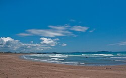
Ngunguru is a coastal settlement in Northland, New Zealand, 26 kilometres (16 mi) north-east of Whangārei. The Ngunguru River flows between the settlement and a long low sandspit into Ngunguru Bay, which stretches southwards. North of Ngunguru are Tutukaka and Matapouri. Just off the Ngunguru coast are the Poor Knights Islands, a protected marine reserve.[3][4]
Ngunguru is a Māori-language word meaning "rumbling tides".[5]
- ^ Cite error: The named reference
Areawas invoked but never defined (see the help page). - ^ "Aotearoa Data Explorer". Statistics New Zealand. Retrieved 26 October 2024.
- ^ Peter Dowling, ed. (2004). Reed New Zealand Atlas. Reed Books. pp. map 8. ISBN 0-7900-0952-8.
- ^ Roger Smith, GeographX (2005). The Geographic Atlas of New Zealand. Robbie Burton. pp. map 25. ISBN 1-877333-20-4.
- ^ "Whangārei tribes". Te Ara: The Encyclopedia of New Zealand. Archived from the original on 5 April 2008.