| Ninigret Pond | |
|---|---|
 Seen in August 2009 | |
| Location | Charlestown, Washington County, Rhode Island |
| Coordinates | 41°22′45″N 71°38′43″W / 41.3792677°N 71.6453401°W |
| Type | coastal lagoon, saline |
| Primary inflows | Precipitation, groundwater |
| Primary outflows | Block Island Sound |
| Catchment area | 7,645.65 acres (30.9408 km2) |
| Basin countries | United States |
| Max. length | 3.91 mi (6.29 km) |
| Max. width | 1.83 mi (2.95 km) |
| Surface area | 1,580.38 acres (6.3956 km2) |
| Average depth | 4.3 ft (1.3 m) |
| Surface elevation | 0 ft (0 m) |
| Islands | 8 |
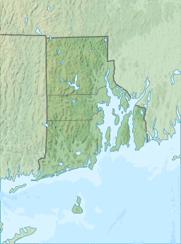
Ninigret is a coastal lagoon in Charlestown, Rhode Island, in the United States, located at 41°22′45″N 71°38′43″W / 41.3792677°N 71.6453401°W.[1][2] It is the largest of the nine lagoons, or "salt ponds", in southern Rhode Island.[3][4] It is utilized for recreational activities, as well as oyster and quahog harvesting. Found along its shores are "extensive" archaeological remains.[1] Ninigret Pond, like others in the region, was "formed after the recession of the glaciers 12,000 years ago".[5] The pond is situated on low-lying ground, and as such, it is considered particularly vulnerable to storm surge flooding.[4] It is connected to Green Hill Pond via a small channel.[6]
The pond is located within the Ninigret National Wildlife Refuge. Both are named for Ninigret, a 17th-century sachem of the eastern Niantic aboriginal American tribe.
- ^ a b "Salt Ponds of Rhode Island" (PDF). Rhode Island Sea Grant. Archived from the original (PDF) on May 17, 2008. Retrieved June 12, 2009.
- ^ Peter Lord (January 9, 2005). "Shifting sands". The Providence Journal. Retrieved June 11, 2009.
- ^ S.W. Nixon and B. A. Buckley (2007). "Nitrogen Inputs to Rhode Island Coastal Salt – Too Much of a Good Thing" (PDF). Rhode Island Department of Environmental Management. Retrieved May 25, 2009.
- ^ a b "Rhode Island's Salt Pond Region: A Special Area Management Plan" (PDF). Rhode Island Coastal Resources Management Council. Retrieved June 12, 2009.
- ^ "What is a Salt Pond?". Salt Ponds Coalition. Archived from the original on October 9, 2010. Retrieved June 11, 2009.
- ^ Arthur Ganz. "Daytripper's Guide: Ninigret Pond". Rhode Island Sea Grant. Retrieved June 12, 2009.
