Niya County
Minfeng | |
|---|---|
 | |
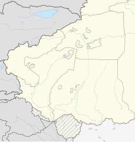
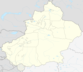
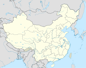
 Niya County (red) in Hotan Prefecture (yellow) and Xinjiang | |
| Coordinates: 37°04′N 82°46′E / 37.067°N 82.767°E | |
| Country | China |
| Autonomous region | Xinjiang |
| Prefecture | Hotan |
| County seat | Niya |
| Area | |
| • Total | 56,759.86 km2 (21,915.10 sq mi) |
| Population (2020)[3] | |
| • Total | 42,649 |
| • Density | 0.75/km2 (1.9/sq mi) |
| Ethnic groups | |
| • Major ethnic groups | Uyghur[4] |
| Time zone | UTC+8 (China Standard[a]) |
| Postal code | 848500 |
| Website | www |
| Niya County | |||||||||||
|---|---|---|---|---|---|---|---|---|---|---|---|
| Uyghur name | |||||||||||
| Uyghur | نىيە ناھىيىسى | ||||||||||
| |||||||||||
| Chinese name | |||||||||||
| Simplified Chinese | 民丰县 | ||||||||||
| Traditional Chinese | 民豐縣 | ||||||||||
| |||||||||||
| Alternative Chinese name | |||||||||||
| Simplified Chinese | 尼雅县 | ||||||||||
| Traditional Chinese | 尼雅縣 | ||||||||||
| |||||||||||
Niya County[5][6][7] (transliterated from the Uyghur نىيە ناھىيىسى Niyă Nahiyisi ; Chinese: 尼雅县), also from Mandarin Chinese as Minfeng County (Chinese: 民丰县), is a county within the Xinjiang Uyghur Autonomous Region and is under the administration of the Hotan Prefecture. It contains an area of 56,726 km2 (21,902 sq mi). According to the 2002 census, it has a population of 30,000.[8] The county is bordered to the north by Xayar County, to the east by Qiemo/Qarqan County, to the west by Yutian / Keriya County and to the south by Ngari Prefecture in Tibet.
The county seat is in the town of Niya, which is often referred to by the county name (Minfeng) as well. The Niya ruins are located 115 km north of Niya.
- ^ Cite error: The named reference
xzqhmfwas invoked but never defined (see the help page). - ^ 夏征农; 陈至立, eds. (September 2009). 辞海:第六版彩图本 [Cihai (Sixth Edition in Color)] (in Chinese). 上海. Shanghai: 上海辞书出版社. Shanghai Lexicographical Publishing House. p. 1580. ISBN 9787532628599.
面积5.67万平方千米。{...}1945年由和阗县(今和田县)析置民丰设治局,1947年改民丰县。经济以农、牧业为主,产玉米、小麦、棉花和羊毛。工业有电力、农机修造、食品加工、地毯、建材等。
- ^ Xinjiang: Prefectures, Cities, Districts and Counties
- ^ 1997年民丰县行政区划. XZQH.org (in Simplified Chinese). 6 January 2011. Retrieved 24 March 2020.
其中维吾尔族占91%,辖1镇、5乡。
- ^ Ministry of Housing and Urban-Rural Development (2010). 建筑抗震设计规范 [GB50011-2010: Code for Seismic Design of Buildings] (in English and Simplified Chinese). Beijing: China Architecture & Building Press. p. 203 – via Google Books.
Niya County
- ^ "'Many Uygurs like to drink': Chinese academic defends beer festival in Muslim region". South China Morning Post. 24 June 2015. Retrieved 24 March 2020.
Xinjiang's government-run Tianshan website showed that officials in Niya county organised an event where local Muslims made and ate rice dumplings on Saturday, three days after the start of Ramadan, during which devout Muslims abstain from all food and drink during daylight hours.
- ^ Cite error: The named reference
reuterswas invoked but never defined (see the help page). - ^ The Silk Road - China and the Karakorum Highway: A Travel Companion 1780763565 Jonathan Tucker - 2015 - Niya, north of Minfeng, Xinjiang province (photograph by Antonia Tozer) Wooden tablet written in Kharosthi (Spink and Son Ltd.) The Shanpula cemetery, Luopu county, near Khotan, Xinjiang province (photograph by Antonia Tozer) Remains.
Cite error: There are <ref group=lower-alpha> tags or {{efn}} templates on this page, but the references will not show without a {{reflist|group=lower-alpha}} template or {{notelist}} template (see the help page).


