This article includes a list of general references, but it lacks sufficient corresponding inline citations. (January 2017) |
Noney district | |
|---|---|
 Location in Manipur | |
| Coordinates: 24°48′N 93°36′E / 24.8°N 93.6°E | |
| Country | |
| State | Manipur |
| Headquarters | Noney |
| Area | |
| • Total | 1,076 km2 (415 sq mi) |
| • Rank | 10 |
| Language(s) | |
| • Official | Meitei (Manipuri) and English [a][1] |
| • Regional | Rongmei |
| Time zone | UTC+05:30 (IST) |
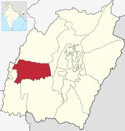
Noney district (Meitei pronunciation: /nō-né/[b][1]) is a district in Manipur, India, created by bifurcating erstwhile Tamenglong district.
The district headquarters is located in Longmai.
Cite error: There are <ref group=lower-alpha> tags or {{efn}} templates on this page, but the references will not show without a {{reflist|group=lower-alpha}} template or {{notelist}} template (see the help page).
- ^ a b "Report of the Commissioner for linguistic minorities: 47th report (July 2008 to June 2010)" (PDF). Commissioner for Linguistic Minorities, Ministry of Minority Affairs, Government of India. p. 78. Archived from the original (PDF) on 13 May 2012. Retrieved 16 February 2012.