Norderney | |
|---|---|
 Aerial view of Norderney from the west | |
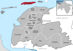
Location of Norderney within Aurich district  | |
| Coordinates: 53°42′26″N 07°08′49″E / 53.70722°N 7.14694°E | |
| Country | Germany |
| State | Lower Saxony |
| District | Aurich |
| Subdivisions | 2 Ortsteile Fischerhafen, Nordhelmsiedlung |
| Government | |
| • Mayor (2019–24) | Frank Ulrichs[1] |
| Area | |
| • Total | 26.3 km2 (10.2 sq mi) |
| Elevation | 5 m (16 ft) |
| Population (2022-12-31)[2] | |
| • Total | 5,992 |
| • Density | 230/km2 (590/sq mi) |
| Time zone | UTC+01:00 (CET) |
| • Summer (DST) | UTC+02:00 (CEST) |
| Postal codes | 26548 |
| Dialling codes | 04932 |
| Vehicle registration | AUR, NOR |
| Website | www.norderney.de |


Norderney (German pronunciation: [ˌnɔʁdɐˈnaɪ̯] ; Low German: Nördernee) is one of the seven populated East Frisian Islands off the North Sea coast of Germany.
The island is 14 by 2.5 kilometres (8.7 by 1.6 mi), having a total area of about 26.3 square kilometres (10.2 sq mi) and is therefore Germany's ninth-largest island. Norderney's population amounts to about 5,850[3] people. In 1946 Norderney gained municipal status and belongs to the Aurich "Kreis" (county). On the northern side of the island lies a 14-kilometre (8.7 mi) long sandy beach.
The neighbouring island to the east is Baltrum, which lies about 800m (half a mile) away beyond the Wichter Ee. To the west is the island of Juist, about 3 kilometres (1.9 mi) away on the other side of the Norderneyer Seegatt.
The entire eastern half of Norderney belongs to the Lower Saxon Wadden Sea National Park. Access to the park is restricted, as it is subdivided in zones of different accessibility for the protection of the wildlife. The status as a National Park also affects all types of traffic on the island, while especially car traffic is subject to strict regulations.
The mainland is easily reached via ferry operated by AG Reederei Norden-Frisia from the harbour, Norddeich pier near the northern German city of Norden. Norderney also possesses an airport with a 1,000-metre (3,300 ft) runway.
- ^ "Verzeichnis der direkt gewählten Bürgermeister/-innen und Landräte/Landrätinnen". Landesamt für Statistik Niedersachsen. April 2021.
- ^ "LSN-Online Regionaldatenbank, Tabelle A100001G: Fortschreibung des Bevölkerungsstandes, Stand 31. Dezember 2022" (in German). Landesamt für Statistik Niedersachsen.
- ^ "Zensusdatenbank - Ergebnisse des Zensus 2011". ergebnisse.zensus2011.de. Retrieved 2016-11-24.


