North Island Volcanic Plateau
Central Plateau, Waimarino Plateau | |
|---|---|
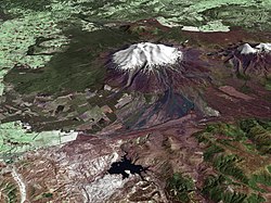
 Composite satellite image of Mount Ruapehu | |
 | |
| Coordinates: 39°02′27″S 175°44′04″E / 39.04083°S 175.73444°E | |
| Location | North Island, New Zealand |
| Formed by | Volcanic action |
| Dimensions | |
| • Length | 125 km (78 mi) |
| • Width | 60 km (37 mi) |
| Highest elevation | 2,797 m (9,177 ft) |
| Volcanic arc/belt | Taupō Volcanic Zone |
| Elevation | above 300 m (980 ft) |
| Water bodies | Lake Taupō, Lake Rotorua, Lake Tarawera, Lake Rotoiti, Lake Rotomā, Lake Ōkataina, Lake Rotokākahi, Lake Ōkareka, Lake Tikitapu, Lake Rotomahana, Lake Rotoehu |
| River systems | Waikato River, Kaituna River, Whanganui River |
The North Island Volcanic Plateau (often called the Central Plateau and occasionally the Waimarino Plateau) is a volcanic plateau covering much of central North Island of New Zealand with volcanoes, lava plateaus, and crater lakes. It contains the Taupō caldera complex, Ōkataina caldera complex and Tongariro Volcanic Centre resulting in it being currently the most frequently active and productive area of silicic volcanism on Earth.[1] New Zealand is part of the Pacific Ring of Fire.