North Siberian Lowland
Северо-Сибирская низменность / Хотугу Сибиир намтала | |
|---|---|
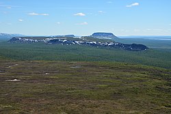
 Landscape of the North Siberian Lowland. | |
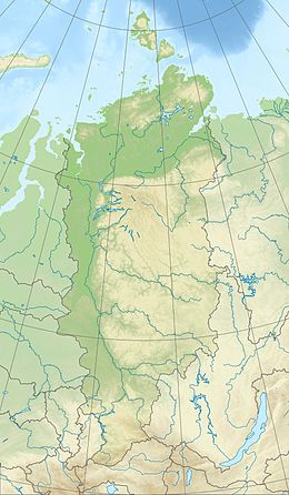
| Coordinates: 72°N 101°E / 72°N 101°E | |
| Location | Krasnoyarsk Krai, Russia |
| Part of | Siberia |
| Dimensions | |
| • Length | 1,400 km (870 mi) |
| • Width | 600 km (370 mi) |
| Elevation | 0 meters (0 ft) to 300 meters (980 ft) |
The North Siberian Lowland (Russian: Северо-Сибирская низменность, romanized: Severo-Sibirskaya nizmennost; Yakut: Хотугу Сибиир намтала, romanized: Xotugu Sibîr namtala), also known as Taymyr Lowland (Russian: Таймырская низменность, romanized: Taymyrskaya nizmennost), is a plain with a relatively flat relief separating the Byrranga Mountains of the Taymyr Peninsula in the north from the Central Siberian Plateau in the south.[1][page range too broad] To the southeast of the Olenyok basin the lowland merges with the Central Yakutian Lowland.[2]
The territory of the lowland is one of the Great Russian Regions. Administratively it is mostly part of the Krasnoyarsk Krai, with a small section in the Sakha Republic (Yakutia). The main towns are Dudinka, Norilsk and Khatanga.[2]
- ^ Kimble, John, ed. (2004). Cryosols: Permafrost-Affected Soils. Berlin: Springer. ISBN 3-540-20751-1.
- ^ a b Google Earth

