| Northern Muya Range Се́веро-Му́йский хребе́т | |
|---|---|
 View of the Northern Muya Range from a train on the Baikal Amur Mainline. | |
| Highest point | |
| Elevation | 2,537 m (8,323 ft) |
| Coordinates | 55°47′19″N 111°40′45″E / 55.78861°N 111.67917°E |
| Dimensions | |
| Length | 350 km (220 mi) ENE-WSW |
| Geography | |
| Country | Russia |
| Federal subject | Buryatia / Irkutsk Oblast |
| Range coordinates | 56°5′0″N 114°30′0″E / 56.08333°N 114.50000°E |
| Parent range | Stanovoy Highlands South Siberian System |
| Geology | |
| Rock type(s) | Granites, crystalline schistss |
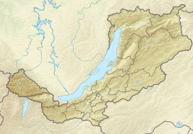
The Northern Muya Range (Russian: Се́веро-Му́йский хребе́т, romanized: Severo-Muyskiy khrebet) is a mountain range in Buryatia, Russia, part of the Stanovoy Highlands.[1]
The Baikal Amur Mainline (BAM) railway traverses the southern end of the mountain range via the Severomuysky Tunnel.
