Новая Земля (Russian) | |
|---|---|
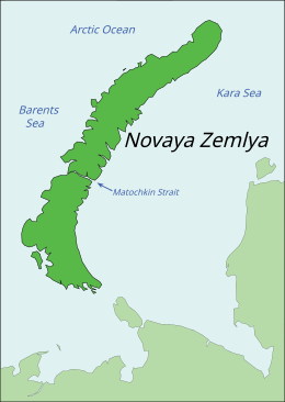
 Map of Novaya Zemlya | |
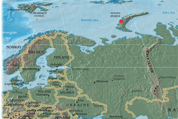
 Location of Novaya Zemlya, including the site of the Tsar Bomba detonation | |
| Geography | |
| Location | Arctic Ocean |
| Coordinates | 74°N 56°E / 74°N 56°E |
| Major islands | 2 |
| Area | 83,000 km2 (32,000 sq mi) |
| Highest elevation | 1,547 m (5075 ft) |
| Highest point | Gora Kruzenshterna |
| Administration | |
Russia | |
| Federal subject | Arkhangelsk Oblast |
| Largest settlement | Belushya Guba (pop. 1,972) |
| Demographics | |
| Population | 3,576 (2021) |
| Pop. density | 0.04/km2 (0.1/sq mi) |
| Additional information | |
Flag Seal | |
Novaya Zemlya (/ˌnoʊvəjə ˈzɛmliə/, also UK: /ˌnɒv-, -aɪ.ə -/, US: /- zɛmˈl(j)ɑː/;[1][2] Russian: Новая Земля, IPA: [ˈnovəjə zʲɪmˈlʲa]; lit. 'New Land'), also spelled Novaja Zemlja, is an archipelago in northern Russia. It is situated in the Arctic Ocean, in the extreme northeast of Europe, with Cape Flissingsky, on the northern island, considered the easternmost point of Europe. To Novaya Zemlya's west lies the Barents Sea and to the east is the Kara Sea.
Novaya Zemlya consists of two main islands, the northern Severny Island and the southern Yuzhny Island, which are separated by the Matochkin Strait. Administratively, it is incorporated as Novaya Zemlya District, one of the twenty-one in Arkhangelsk Oblast, Russia.[3] Municipally, it is incorporated as Novaya Zemlya Urban Okrug.[4]
Novaya Zemlya was a sensitive military area during the Cold War, and parts of it are still used for airfields today. The Soviet Air Force maintained a presence at Rogachevo on the southern part of the southern island, on the westernmost peninsula (71°37′04″N 52°28′44″E / 71.61787°N 52.47884°E). It was used primarily for interceptor aircraft operations, but also provided logistical support for the nearby nuclear test area. Novaya Zemlya was one of the two major nuclear test sites managed by the USSR along with the Semipalatinsk Test Site; it was used for air drops and underground testing of the largest of Soviet nuclear bombs, in particular the October 30, 1961, air burst explosion of Tsar Bomba, the largest, most powerful nuclear weapon ever detonated.
- ^ Wells, John C. (2008). Longman Pronunciation Dictionary (3rd ed.). Longman. ISBN 978-1-4058-8118-0.
- ^ Upton, Clive; Kretzschmar, William A. Jr. (2017). The Routledge Dictionary of Pronunciation for Current English (2nd ed.). Routledge. p. 910. ISBN 978-1-138-12566-7.
- ^ Law #65-5-OZ
- ^ Law #258-vneoch.-OZ

