| Nowitna River | |
|---|---|
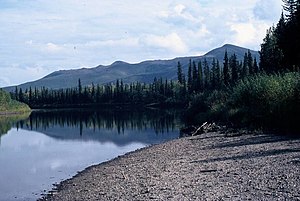
 Gravel bar in the Nowitna National Wildlife Refuge | |
| Location | |
| Country | United States |
| State | Alaska |
| Census Area | Yukon–Koyukuk |
| Physical characteristics | |
| Source | Kuskokwim Mountains |
| • coordinates | 63°30′28″N 155°32′34″W / 63.50778°N 155.54278°W[1] |
| • elevation | 1,688 ft (515 m)[2] |
| Mouth | Yukon River[3] |
• location | 38 miles (61 km) northeast of Ruby |
• coordinates | 64°55′38″N 154°16′11″W / 64.92722°N 154.26972°W[1] |
• elevation | 154 ft (47 m)[1] |
| Length | 250 mi (400 km)[3] |
| Type | Wild 223.0 miles (358.9 km) |
| Designated | December 2, 1980[4] |
The Nowitna River is a 250-mile (400 km) tributary of the Yukon River in the U.S. state of Alaska.[3] The river flows northeast from the Kuskokwim Mountains through Nowitna National Wildlife Refuge and enters the larger river 38 miles (61 km) northeast of Ruby[3] and southwest of Tanana.[5] Major tributaries include the Titna, Big Mud, Little Mud, Lost, and Sulatna rivers.[5]
In 1980, the 225 miles (362 km) of the river within the wildlife refuge were designated "wild" and added to the National Wild and Scenic Rivers System.[6] The designation means that most of the Nowitna is unpolluted, free-flowing, and generally inaccessible except by trail.[7]
- ^ a b c "Nowitna River". Geographic Names Information System. United States Geological Survey. January 1, 2000. Retrieved October 19, 2013.
- ^ Derived by entering source coordinates in Google Earth.
- ^ a b c d Orth, Donald J.; United States Geological Survey (1971) [1967]. Dictionary of Alaska Place Names: Geological Survey Professional Paper 567 (PDF). University of Alaska Fairbanks. p. 705. Archived from the original (PDF) on October 17, 2013. Retrieved October 12, 2013.
{{cite book}}: Unknown parameter|agency=ignored (help) - ^ "National Wild and Scenic Rivers System". rivers.gov. National Wild and Scenic Rivers System. Retrieved 2023-01-05.
- ^ a b Alaska Atlas & Gazetteer (7th ed.). Yarmouth, Maine: DeLorme. 2010. pp. 130 and 110–11. ISBN 978-0-89933-289-5.
- ^ "Nowitna River, Alaska". National Wild and Scenic Rivers System. Retrieved October 19, 2013.
- ^ "About the WSR Act". National Wild and Scenic Rivers System. Retrieved October 19, 2013.
