Oak Flat
| |
|---|---|
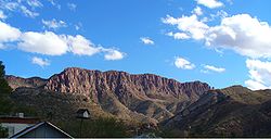
 Apache Leap cliff | |
| Coordinates: 33°18′29″N 111°02′49″W / 33.308°N 111.047°W | |
| Location | Tonto National Forest |
| Native name |
|
| Area | |
| • Total | 6.7 square miles (17 km2)[1] |
| Website | Official website |
Chíchʼil Bił Dagoteel (Oak Flat Campground) | |
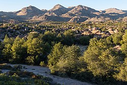
 Emory oak trees at Oak Flat | |
| Location | Tonto National Forest |
| NRHP reference No. | 16000002 |
| Added to NRHP | March 4, 2016 |
Oak Flat (Western Apache: Chíchʼil Bił Dagoteel, Navajo: Chéchʼil Bił Dahoteel) is in Pinal County about 40 miles (64 km) east of Phoenix in the Tonto National Forest, a high desert setting at 3,900 feet (1,200 m) elevation. The land is sacred to Native Americans from the San Carlos Apache Indian Reservation and many other Arizona tribes. This federally-protected area is listed on the National Register of Historic Places, and features a National Forest Service public campground. The landscape includes Apache Leap cliff, the mesa of Oak Flat, and Devil's Canyon (Apaches refer to it as Ga'an Canyon, or "Angels Canyon"), all of which have long been popular with hikers, birders, climbers, off-roaders, hunters, and members of the area's indigenous tribes. Oak Flat has been subject to attempts by the federal government to sell it to mining interests since 2002, against the wishes of the San Carlos Apache tribe.

