Ogndal Municipality
Ogndal herred | |
|---|---|
| Ogndalen herred (historic name) Skei herred (historic name) | |
 View of the Skei area in Ogndal | |
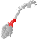
 Trøndelag within Norway | |
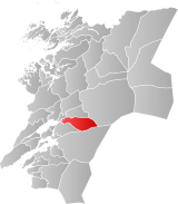
 Ogndal within Trøndelag | |
| Coordinates: 64°01′11″N 11°37′52″E / 64.01972°N 11.63111°E | |
| Country | Norway |
| County | Trøndelag |
| District | Innherred |
| Established | 1 Jan 1885 |
| • Preceded by | Sparbu Municipality |
| Disestablished | 1 Jan 1964 |
| • Succeeded by | Steinkjer Municipality |
| Administrative centre | Steinkjer |
| Area (upon dissolution) | |
| • Total | 418 km2 (161 sq mi) |
| Population (1964) | |
| • Total | 2,678 |
| • Density | 6.4/km2 (17/sq mi) |
| Demonym | Ogndaling[1] |
| Time zone | UTC+01:00 (CET) |
| • Summer (DST) | UTC+02:00 (CEST) |
| ISO 3166 code | NO-1732[2] |
Ogndal is a former municipality in what was the old Nord-Trøndelag county, Norway. The 418-square-kilometre (161 sq mi) municipality existed from 1885 until its dissolution in 1964. The municipality included the whole Ogndalen valley and areas to the west, up to, but not including the town of Steinkjer in what is now the central and western part of the municipality of Steinkjer in Trøndelag county. Starting in 1917, the administrative center of Ogndal was actually located in the town of Steinkjer (even though that was not a part of Ogndal municipality).[3][4]
The main church for Ogndal, Skei Church, is located in the village of Skei in western Ogndal. Another church, Bodom Chapel, is located in the eastern part of the municipality.
- ^ "Navn på steder og personer: Innbyggjarnamn" (in Norwegian). Språkrådet.
- ^ Bolstad, Erik; Thorsnæs, Geir, eds. (26 January 2023). "Kommunenummer". Store norske leksikon (in Norwegian). Kunnskapsforlaget.
- ^ Steinkjerleksikonet. "Ogndal kommune" (in Norwegian). Retrieved 16 July 2011.
- ^ Thorsnæs, Geir, ed. (5 February 2018). "Ogndal". Store norske leksikon (in Norwegian). Kunnskapsforlaget. Retrieved 7 April 2018.