 | ||||
| Route information | ||||
| Maintained by ODOT | ||||
| Length | 48.67 mi[1] (78.33 km) | |||
| Existed | 1924–present | |||
| Major junctions | ||||
| South end | ||||
| North end | ||||
| Location | ||||
| Country | United States | |||
| State | Ohio | |||
| Counties | Fayette, Madison, Union | |||
| Highway system | ||||
| ||||
| ||||

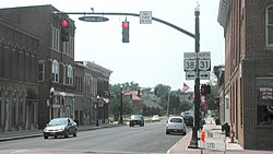
State Route 38 (SR 38) is a south–north state highway in the state of Ohio. Its southern terminus is near Bloomingburg and Washington Court House at the U.S. Route 62 / SR 3 concurrency and its northern terminus is in Marysville at the intersection of 5th Street and Main Street where the road continues north as SR 31.
On its winding route through central Ohio, State Route 38 mainly offers views of rolling or flat farmland planted with corn, soybeans, and other crops. It also passes through a variety of towns including Bloomingburg, London, and Marysville.
- ^ "DESTAPE". Ohio Department of Transportation. July 3, 2014. Retrieved July 13, 2015.
- Fayette County (mileage calculated from SR 238's mileposts and SR 38's north of 238's former terminus)
- Madison County
- Union County
