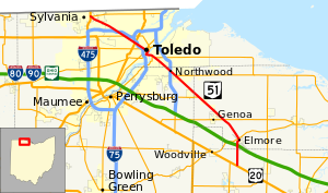
State highway in northwestern Ohio, US
State Route 51 (SR 51) is a northwest-southeast highway (signed north-south) in northwest Ohio. Its southern terminus is at U.S. Route 20 just south of Elmore, Ohio, and its northern terminus is at its interchange, along with State Route 184, at U.S. Route 23 in Sylvania, Ohio. Before an ODOT signage project in 2010, the northern (western) portion of the route, from its northern (western) terminus to the Maumee River was signed as an east-west route. The portion from the Maumee to its southern (eastern) terminus was signed north-south. ODOT has now signed all portions as north-south.

