| Oker | |
|---|---|
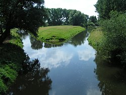
 Confluence of the Oker and Aller near Müden | |
 | |
| Location | |
| Country | Germany |
| Physical characteristics | |
| Source | |
| • location | Harz Mountains |
| • coordinates | 51°46′42″N 10°29′29″E / 51.77833°N 10.49139°E |
| • elevation | 900 metres (3,000 ft) |
| Mouth | |
• location | Aller |
• coordinates | 52°31′26″N 10°21′39″E / 52.52389°N 10.36083°E |
| Length | 128.2 km (79.7 mi)[1] |
| Basin size | 1,822 km2 (703 sq mi)[1] |
| Basin features | |
| Progression | Aller→ Weser→ North Sea |
The Oker (pronounced [ˈoːkɐ]) is a river in Lower Saxony, Germany, that has historically formed an important political boundary. It is a left tributary of the River Aller, 128 kilometres (80 mi) in length and runs in a generally northerly direction.