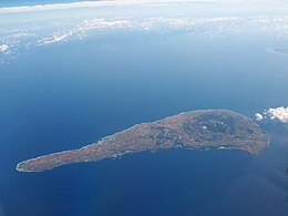
 Aerial view of the island. (2013) | |
 | |
| Geography | |
| Location | East China Sea |
| Coordinates | 27°22′08″N 128°34′00″E / 27.36889°N 128.56667°E |
| Archipelago | Amami Islands |
| Area | 93.63 km2 (36.15 sq mi) |
| Length | 20 km (12 mi) |
| Width | 7 km (4.3 mi) |
| Coastline | 50 km (31 mi) |
| Highest elevation | 246 m (807 ft) |
| Highest point | Ōyama |
| Administration | |
Japan | |
| Prefectures | Kagoshima Prefecture |
| District | Ōshima District |
| Demographics | |
| Population | 13,767 (2012) |
| Pop. density | 150/km2 (390/sq mi) |
| Ethnic groups | Ryukyuan, Japanese |
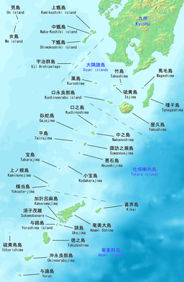
Okinoerabujima (沖永良部島, Okinoerabu: いぃらぶ Yirabu, archaic Northern Ryukyuan: せりよさ Seriyosa), also known as Okinoerabu, is one of the Satsunan Islands, classed with the Amami archipelago between Kyūshū and Okinawa.[1]
The island, 93.63 km2 in area, has a population of approximately 14,000 persons. Administratively it is divided into the towns of Wadomari and China in Kagoshima Prefecture. Much of the island is within the borders of the Amami Guntō National Park.
- ^ Teikoku's Complete Atlas of Japan, Teikoku-Shoin Co., Ltd., Tokyo, ISBN 4-8071-0004-1