| Ole Bull State Park | |
|---|---|
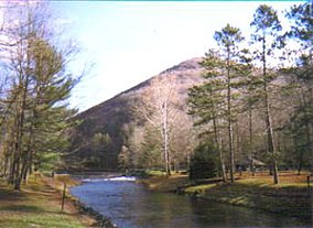
 Kettle Creek flowing through Ole Bull State Park | |
| Location | Stewardson, Potter, Pennsylvania, United States |
| Coordinates | 41°32′10″N 77°42′44″W / 41.53611°N 77.71222°W |
| Area | 132 acres (53 ha) |
| Elevation | 1,417 ft (432 m)[1] |
| Established | 1925 |
| Named for | Ole Borneman Bull |
| Governing body | Pennsylvania Department of Conservation and Natural Resources |
| Website | Ole Bull State Park |
Ole Bull State Park is a 132-acre (53 ha) Pennsylvania state park in Stewardson Township, Potter County, Pennsylvania in the United States. The park is located on Pennsylvania Route 144, 26 miles (42 km) north of Renovo and 18 miles (29 km) south of Galeton. Ole Bull State Park is in the Kettle Creek Valley, and is surrounded by Susquehannock State Forest. The woods surrounding the park are called the Black Forest because of its once dense tree cover.
- ^ "Ole Bull State Park". Geographic Names Information System. United States Geological Survey. August 30, 1990. Retrieved June 18, 2008.

