Olive Branch Airport | |||||||||||
|---|---|---|---|---|---|---|---|---|---|---|---|
| Summary | |||||||||||
| Airport type | Public use | ||||||||||
| Owner | City of Olive Branch | ||||||||||
| Serves | Olive Branch, Mississippi | ||||||||||
| Elevation AMSL | 402 ft / 123 m | ||||||||||
| Coordinates | 34°58′44″N 089°47′13″W / 34.97889°N 89.78694°W | ||||||||||
| Map | |||||||||||
 | |||||||||||
| Runways | |||||||||||
| |||||||||||
| Statistics | |||||||||||
| |||||||||||
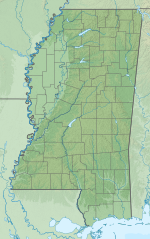
Olive Branch Airport (IATA: OLV[2], ICAO: KOLV, FAA LID: OLV) is owned by the City of Olive Branch. It is a public use airport in De Soto County, Mississippi, United States.[1] It is located three nautical miles (6 km) northeast of the central business district of Olive Branch, Mississippi.[1] This airport was included in the National Plan of Integrated Airport Systems for 2021–2025, which categorized it as a general aviation reliever airport.[3]
The airport is about a 30-minute drive from downtown Memphis, Tennessee and 10 minutes from the Memphis city limits, making it an easily accessible satellite airport for the general aviation and business air travel communities wanting to access the East Memphis/Germantown/Collierville area.[4] It is owned and operated by the City of Olive Branch.[5]
- ^ a b c FAA Airport Form 5010 for OLV PDF. Federal Aviation Administration. effective April 21, 2022.
- ^ "IATA Airport Code Search (OLV: Olive Branch)". International Air Transport Association. Retrieved August 13, 2013.
- ^ "2011–2015 NPIAS Report, Appendix A" (PDF, 2.03 MB). National Plan of Integrated Airport Systems. Federal Aviation Administration. October 4, 2010.
- ^ Zero to Jet.V2.htm AirVenture Flight Center Introduces 'Zero to Jet' Accelerated Regional Airline Training Program[permanent dead link], news release from Belz Metro Industrial Park, June 2007
- ^ "Our History". City of Olive Branch, Mississippi. Archived from the original on 2009-02-14.

