Omeo Highway | |
|---|---|
 | |
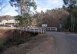
| Omeo Highway crossing Cobungra River at Anglers Rest | |
| Coordinates | |
| General information | |
| Type | Highway |
| Length | 162.8 km (101 mi)[3] |
| Gazetted | February 1914 (as Main Road)[1] February 1925 (as State Highway)[2] |
| Route number(s) | |
| Former route number | (Tallangatta–Bairnsdale) |
| Major junctions | |
| North end | Tallangatta, Victoria |
| South end | Omeo, Victoria |
| Location(s) | |
| Region | Hume, Gippsland[4] |
| Major settlements | Eskdale, Mitta Mitta, Anglers Rest |
| Highway system | |
| ---- | |
Omeo Highway is a 163 kilometre rural highway in eastern Victoria, Australia, connecting Tallangatta on Lake Hume in north-east Victoria to Bairnsdale in East Gippsland,[5] over parts of the Victorian Alps.
- ^ "Victorian Government Gazette". State Library of Victoria. 18 February 1914. p. 955. Retrieved 19 June 2024.
- ^ "Country Roads Board Victoria. Twelfth Annual Report: for the year ended 30 June 1925". Country Roads Board of Victoria. Melbourne: Victorian Government Library Service. 31 December 1925. p. 3.
- ^ "Omeo Highway" (Map). Google Maps. Retrieved 19 June 2024.
- ^ "Victoria's Regions". Regional Development Victoria. Victoria State Government. 11 August 2021. Retrieved 16 June 2022.
- ^ Cite error: The named reference
vicregwas invoked but never defined (see the help page).
