This article needs additional citations for verification. (March 2012) |
Native name: Онекотан 温禰古丹島 | |
|---|---|
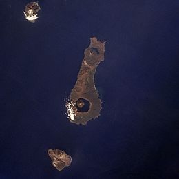
 Onekotan Island (centre) from space, October 1994. North at top | |
 | |
| Geography | |
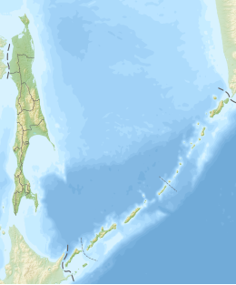
| Location | Sea of Okhotsk |
| Coordinates | 49°27′N 154°46′E / 49.450°N 154.767°E |
| Archipelago | Kuril Islands |
| Area | 425 km2 (164 sq mi) |
| Highest elevation | 1,324 m (4344 ft) |
| Highest point | Krenitsyn |
| Administration | |
Russia | |
| Demographics | |
| Population | 0 |
| Ethnic groups | Ainu (formerly) |
 | |
Onekotan (Russian: Онекотан; Japanese 温禰古丹島; Onekotan-tō, occasionally Onnekotan-tō, Ainu: オネコタン or オネコタㇴ) is an uninhabited volcanic island located near the northern end of the Kuril Islands chain in the Sea of Okhotsk in the northwest Pacific Ocean. Its name is derived from the Ainu language for "large village”. It is the second largest island, after Paramushir, in the northern subgroup of the Kurils. It is administratively included in the Severo-Kurilsky District of Sakhalin oblast, Russia.
