Parts of this article (those related to demographics) need to be updated. (November 2023) |
Orangeville, Utah | |
|---|---|
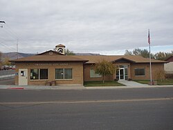
 Orangeville City Office | |
 Location in Emery County and the state of Utah | |
 Location of Utah in the United States | |
| Coordinates: 39°13′37″N 111°3′22″W / 39.22694°N 111.05611°W | |
| Country | United States |
| State | Utah |
| County | Emery |
| Founded | 1878 |
| Incorporated | June 6, 1901 |
| Became a city | March 1921 |
| Named for | Orange Seely |
| Area | |
| • Total | 1.43 sq mi (3.69 km2) |
| • Land | 1.43 sq mi (3.69 km2) |
| • Water | 0.00 sq mi (0.00 km2) |
| Elevation | 5,778 ft (1,761 m) |
| Population (2010) | |
| • Total | 1,470 |
| • Estimate (2019)[2] | 1,326 |
| • Density | 929.87/sq mi (359.05/km2) |
| Time zone | UTC-7 (Mountain (MST)) |
| • Summer (DST) | UTC-6 (MDT) |
| ZIP code | 84537 |
| Area code | 435 |
| FIPS code | 49-56860[3] |
| GNIS feature ID | 1431021[4] |
| Website | orangevillecity |
Orangeville is a city in northwestern Emery County, Utah, United States, at the edge of the Manti-La Sal National Forest. The city is at the junction of State Routes 29 and 57, straddling the banks of Cottonwood Creek. The population was 1,470 at the 2010 census.[5]
- ^ "2019 U.S. Gazetteer Files". United States Census Bureau. Retrieved August 7, 2020.
- ^ Cite error: The named reference
USCensusEst2019CenPopScriptOnlyDirtyFixDoNotUsewas invoked but never defined (see the help page). - ^ "U.S. Census website". United States Census Bureau. Retrieved January 31, 2008.
- ^ "US Board on Geographic Names". United States Geological Survey. October 25, 2007. Retrieved January 31, 2008.
- ^ "Geographic Identifiers: 2010 Census Summary File 1 (G001): Orangeville city, Utah". American Factfinder. U.S. Census Bureau. Archived from the original on February 13, 2020. Retrieved March 30, 2016.