| Coat of Arms | Map |
|---|---|
 |
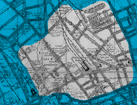
 Map of central Berlin in 1884 showing |
| Basic Information | |
| City: | Berlin |
| Borough: | Mitte |
| Locality: | Mitte and Gesundbrunnen |
| Area: | ? |
| Population: | ? |
| Coordinates: | 52°32′N 13°23′E / 52.533°N 13.383°E |
| Elevation: | 34 m (111 ft) above sea level |

Oranienburger Vorstadt is a historic district of Berlin in what is now the northwestern part of Mitte and the adjacent Gesundbrunnen area, in the modern Mitte borough.