Oregon County | |
|---|---|
 Oregon County Courthouse in Alton | |
 Location within the U.S. state of Missouri | |
 Missouri's location within the U.S. | |
| Coordinates: 36°41′N 91°24′W / 36.69°N 91.4°W | |
| Country | |
| State | |
| Founded | February 14, 1845 |
| Named for | Oregon Territory |
| Seat | Alton |
| Largest city | Thayer |
| Area | |
• Total | 792 sq mi (2,050 km2) |
| • Land | 790 sq mi (2,000 km2) |
| • Water | 1.7 sq mi (4 km2) 0.2% |
| Population (2020) | |
• Total | 8,635 |
| • Density | 11/sq mi (4.2/km2) |
| Time zone | UTC−6 (Central) |
| • Summer (DST) | UTC−5 (CDT) |
| Congressional district | 8th |
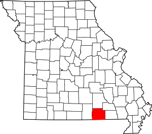
Oregon County is a county located in the southern portion of the U.S. state of Missouri. As of the 2020 census, the population was 8,635.[1] Its county seat is Alton.[2] The county was officially organized on February 14, 1845, and was named for the Oregon Territory in the northwestern United States.
Home to a large area of the Mark Twain National Forest, Oregon County contains more national forest acreage than any county in the state of Missouri. It also contains the Irish Wilderness, the largest federally protected wilderness area in the state. Hiking, backpacking, and horseback riding opportunities abound on the Ozark Trail and the White's Creek Trail. Canoeing, kayaking, jonboating, and fishing are popular on the Eleven Point River, which is Missouri's only National Wild and Scenic River.
Eleven Point State Park is under development east of Alton, Missouri that includes 6 miles of Eleven Point River frontage.[citation needed]
Grand Gulf State Park, just west of Thayer, includes a karst window, a collapsed karst canyon.[citation needed]
- ^ "Explore Census Data". data.census.gov. Retrieved December 26, 2021.
- ^ "Find a County". National Association of Counties. Archived from the original on May 31, 2011. Retrieved June 7, 2011.