Orr, Minnesota | |
|---|---|
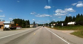
 U.S. Highway 53 serves as a main route in Orr | |
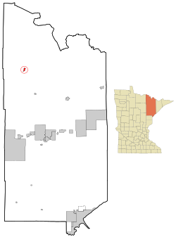
 Location of the city of Orr within Saint Louis County, Minnesota | |
| Coordinates: 48°03′13″N 92°49′52″W / 48.05361°N 92.83111°W | |
| Country | United States |
| State | Minnesota |
| County | Saint Louis |
| Incorporated | June 7, 1935 |
| Government | |
| • Mayor | Robert Antikainen |
| Area | |
| • Total | 1.423 sq mi (3.686 km2) |
| • Land | 1.402 sq mi (3.630 km2) |
| • Water | 0.021 sq mi (0.054 km2) |
| Elevation | 1,303 ft (397 m) |
| Population | |
| • Total | 211 |
| • Estimate (2022)[4] | 214 |
| • Density | 150.50/sq mi (58.13/km2) |
| Time zone | UTC–6 (Central (CST)) |
| • Summer (DST) | UTC–5 (CDT) |
| ZIP Code | 55771 |
| Area code | 218 |
| FIPS code | 27-48634 |
| GNIS feature ID | 0662112[2] |
| Sales tax | 7.375%[5] |
Orr (/ˈɒr/ ORR)[6] is a city in Saint Louis County, Minnesota, United States. The population was 211 at the 2020 census.[3]
U.S. Highway 53 serves as a main route in Orr.
Orr is located within the Kabetogama State Forest in Saint Louis County.
- ^ "2023 U.S. Gazetteer Files". United States Census Bureau. Retrieved April 10, 2024.
- ^ a b U.S. Geological Survey Geographic Names Information System: Orr, Minnesota
- ^ a b "Explore Census Data". United States Census Bureau. Retrieved April 10, 2024.
- ^ Cite error: The named reference
USCensusEst2022was invoked but never defined (see the help page). - ^ "Orr (MN) sales tax rate". Retrieved April 10, 2024.
- ^ "Minnesota Pronunciation Guide". Associated Press. Archived from the original on July 22, 2011. Retrieved July 4, 2011.