Oteha | |
|---|---|
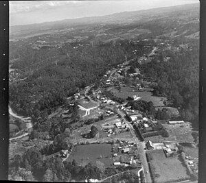
 Historic Aerial view of Oteha | |
 | |
| Coordinates: 36°43′05″S 174°43′01″E / 36.718°S 174.717°E | |
| Country | New Zealand |
| City | Auckland |
| Local authority | Auckland Council |
| Electoral ward | Albany ward |
| Local board | Upper Harbour Local Board |
| Area | |
| • Land | 129 ha (319 acres) |
| Population (June 2024)[2] | |
| • Total | 5,850 |
| Postcode(s) | 0632 |
| Dairy Flat | Fairview Heights | Northcross |
| Albany |
|
Browns Bay |
| Albany | Pinehill | Rothesay Bay |
Oteha is an Auckland suburb, which is under local governance of Auckland Council. The area is defined by Oteha Valley Road on the north, East Coast Road on the east, Spencer Road on the south, and the Auckland Northern Motorway on the west.
- ^ Cite error: The named reference
Areawas invoked but never defined (see the help page). - ^ "Aotearoa Data Explorer". Statistics New Zealand. Retrieved 26 October 2024.