Otumba | |
|---|---|
Municipality | |
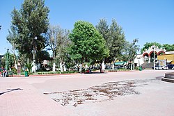
 Main plaza | |
| Coordinates: 19°42′00″N 98°45′20″W / 19.70000°N 98.75556°W | |
| Country | |
| State | State of Mexico |
| Municipal Seat | Otumba de Gómez Farías |
| Municipality Founded | 1824 |
| Elevation (of seat) | 2,360 m (7,740 ft) |
| Population (2005) Municipality | |
| • Municipality | 29,873 |
| • Seat | 9,242 |
| Time zone | UTC-6 (CST) |
| Postal code (of seat) | 55900 |
| Website | www |
Otumba is a municipality in the State of Mexico in Mexico. The municipal seat and largest town is Otumba de Gómez Farías. The municipality of Otumba has a land area of some 143.42 square kilometres (55 sq mi), and a population recorded in the intermedial 2005 census, the Conteo de Población y Vivienda, of 29,873.
