Ozumba
Ozumba 042 | |
|---|---|
Municipality | |
| Ozumba de Alzate | |
 Main Plaza | |
| Coordinates: 19°02′21″N 98°47′37″W / 19.03917°N 98.79361°W | |
| Country | |
| State | State of Mexico |
| Municipal Seat | Ozumba de Alzate |
| Town Founded | 1525 |
| Municipality Founded | 1825 |
| Government | |
| • Municipal President | Hugo González Cortés (2013-2015) |
| Elevation (of seat) | 2,340 m (7,680 ft) |
| Population (2010) Municipality | |
| • Municipality | 27,207 |
| • Seat | 15,717 |
| Time zone | UTC-6 (Central) |
| Postal code (of seat) | 56800 |
| Area code | 597 |
| Website | www |
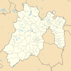
Ozumba is one of 125 municipalities in the State of Mexico. Its municipal seat is the town of Ozumba de Alzate. It is located in the southeast portion of the Valley of Mexico, 70 km southeast of Mexico City near the Mexico City-Cuautla highway.[1] The main feature of this area is the Parish of the Immaculate Conception (Inmaculada Concepción) which began as a Franciscan monastery in the 16th century. The entrance to the cloister area contains murals related to the early evangelization efforts of this order. They include scenes such as Hernán Cortés greeting the first Franciscan missionaries in Mexico, the martyrdom of some of the first young converts to Christianity and even a scene where the monks are flogging Cortés.[2] The church itself inside has suffered the theft of a number of its antique pieces.[3] The name Ozumba comes from Nahuatl meaning "over the streams of water". "de Alzate" was added to the formal name in honor of the scientist José Antonio Alzate y Ramirez Santillana who was born here.[1]
- ^ a b "Enciclopedia de los Municipios de México Estado de Mexico Ozumba" (in Spanish). Mexico: INAFED. Retrieved February 24, 2010. [dead link]
- ^ Arce Valdez, Guillermo. "OZUMBA: Scenes from the Spiritual Conquest" (in Spanish). Mexico: Exploring Colonial Mexico The Espadaña Press Web site. Archived from the original on 2010-09-19. Retrieved 2010-02-24.
- ^ Cite error: The named reference
gavaldezwas invoked but never defined (see the help page).


