| Pactola Dam | |
|---|---|
 | |
| Country | United States |
| Location | Pennington County, South Dakota |
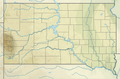
| Coordinates | 44°04′16″N 103°29′10″W / 44.07111°N 103.48611°W |
| Opening date | 1956[1] |
| Dam and spillways | |
| Type of dam | Earthfill |
| Impounds | Rapid Creek |
| Height (foundation) | 245 ft (75 m)[2] |
| Length | 2,236 ft (682 m)[2] |
| Reservoir | |
| Creates | Pactola Lake |
| Total capacity | 99,029 acre⋅ft (122,150,000 m3)[3] |
| Surface area | 1,232 acres (499 ha)[3] |
| Normal elevation | 4,580 ft (1,400 m)[2] |
Pactola Dam is an embankment dam on Rapid Creek in Pennington County, South Dakota, about 10 miles (16 km) west of Rapid City. The dam was completed in 1956 by the U.S. Bureau of Reclamation to provide flood control, water supply and recreation. Along with the nearby Deerfield Dam, it is part of the Rapid Valley Unit of the Pick-Sloan Missouri Basin Program. U.S. Route 385 runs along the crest of the dam. The dam forms Pactola Lake, which at over 1,200 acres (490 ha) is the largest and deepest body of water in the Black Hills.
