This article needs additional citations for verification. (June 2019) |
Pak Kret
ปากเกร็ด | |
|---|---|
| City of Pakkret เทศบาลนครปากเกร็ด[1] | |
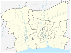
Location in Bangkok Metropolitan Region Location in Thailand | |
| Coordinates: 13°54′45″N 100°29′52″E / 13.91250°N 100.49778°E | |
| Country | |
| Province | Nonthaburi |
| District | Pak Kret |
| Settled | c. 18th century |
| Subdistrict municipality | 1 January 1992 |
| Town municipality | 5 February 1996 |
| City municipality | 20 April 2000 |
| Government | |
| • Type | City Municipality |
| • Mayor | Wichai Bandasak |
| Area | |
| • Total | 36.04 km2 (13.92 sq mi) |
| • Rank | 14th |
| Population (2019)[2] | |
| • Total | 190,272 (Registered residents) |
| • Rank | 3rd |
| • Density | 5,275/km2 (13,660/sq mi) |
| Time zone | UTC+7 (ICT) |
| Postcode | 11120 |
| Calling code | 02 |
| Website | www |
Pak Kret (Thai: ปากเกร็ด, pronounced [pàːk krèt]) is a city (thesaban nakhon) in Nonthaburi province, Thailand. It lies in the Central Thai plains on the east bank of the lower Chao Phraya River, bordering Bangkok to the east, Mueang Nonthaburi district of Nonthaburi province to the south, and Pathum Thani province to the north. It is part of the Bangkok Metropolitan Region megalopolis. With a registered population of 190,272, [2] Pak Kret is the third most populous city municipality (thesaban nakhon) in Thailand.
- ^ "Pakkret Municipality".
- ^ a b "รายงานสถิติจำนวนประชากรและบ้านประจำปี พ.ศ.2562" [Statistics, population and house statistics for the year 2019]. Registration Office Department of the Interior, Ministry of the Interior (in Thai). 31 December 2019. Retrieved 10 March 2020.


