This article needs additional citations for verification. (March 2019) |
| Pan-Philippine Highway | |
|---|---|
| |
 Map of the Philippines showing the route of Pan-Philippine Highway | |
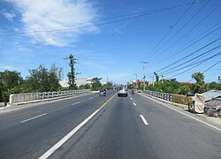
 The segment of the highway in Nueva Ecija | |
| Route information | |
| Maintained by the Department of Public Works and Highways (DPWH) | |
| Length | 3,379.73 km[2] (2,100.07 mi) Excludes sea route Includes 96.98 km (60.26 mi) Tacloban–Ormoc spur and 292.39 km (181.68 mi) Davao–Cagayan de Oro spur |
| Existed | 1960s–present |
| Major junctions | |
| North end | Laoag, Philippines |
| South end | Zamboanga City, Philippines |
| Location | |
| Country | Philippines |
| Regions | |
| Provinces |
|
| Highway system | |
The Pan-Philippine Highway, also known as the Maharlika Highway (Tagalog: Daang Maharlika; Cebuano: Dalang Halangdon), is a network of roads, expressways, bridges, and ferry services that connect the islands of Luzon, Samar, Leyte, and Mindanao in the Philippines, serving as the country's principal transport backbone. Measuring 3,379.73 kilometers (2,100.07 mi) long excluding sea routes not counted by highway milestones, it is the longest road in the Philippines that forms the country's north–south backbone component of National Route 1 (N1) of the Philippine highway network. The entire highway is designated as Asian Highway 26 (AH26) of the Asian Highway Network.[1][2]
The northern terminus of the highway is in front of the Ilocos Norte Provincial Capitol in Laoag and the southern terminus is near the Zamboanga City Hall in Zamboanga City.[1][3]
- ^ a b c "Department Order No. 15, series of 2009: Installation of Route Markers & Directional Signs along the Asian Highway - Route AH26 (Daang Maharlika)" (PDF). Department of Public Works and Highways. March 22, 2009. Retrieved August 8, 2021.
- ^ a b Cabral, Maria Catalina. "Asian Highway 26 (AH26)" (PDF). ESCAP. Department of Public Works and Highways. Retrieved May 16, 2022.
- ^ Cite error: The named reference
dashboardwas invoked but never defined (see the help page).
