| Pantanos de Centla | |
|---|---|
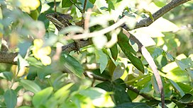
 Brown basilisk (toloque rayado) in the Pantanos de Centla | |
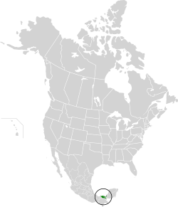
 Location map of the Pantanos de Centla | |
| Ecology | |
| Realm | Neotropical |
| Biome | tropical and subtropical moist broadleaf forests |
| Borders | |
| Geography | |
| Area | 17,028 km2 (6,575 sq mi) |
| Country | Mexico |
| States | |
| Conservation | |
| Conservation status | Critical/endangered |
| Protected | 5,644 km2 (33%)[1] |
| Designations | |
|---|---|
| Official name | Reserva de la Biosfera Pantanos de Centla |
| Designated | 22 June 1995 |
| Reference no. | 733[2] |


The Pantanos de Centla (Centla swamps) are wooded wetlands along the coast in state of Tabasco in Mexico. They have been protected since 2006 with the establishment of the Pantanos de Centla Biosphere Reserve. It is also a World Wildlife Fund ecoregion.
- ^ Eric Dinerstein, David Olson, et al. (2017). An Ecoregion-Based Approach to Protecting Half the Terrestrial Realm, BioScience, Volume 67, Issue 6, June 2017, Pages 534–545; Supplemental material 2 table S1b. [1]
- ^ "Reserva de la Biosfera Pantanos de Centla". Ramsar Sites Information Service. Retrieved 25 April 2018.