Pantnagar Airport | |||||||||||
|---|---|---|---|---|---|---|---|---|---|---|---|
 | |||||||||||
| Summary | |||||||||||
| Airport type | Public | ||||||||||
| Operator | Airports Authority of India | ||||||||||
| Serves | Pantnagar, Rudrapur, Haldwani and Kichha | ||||||||||
| Location | Pantnagar, Uttarakhand, India | ||||||||||
| Elevation AMSL | 233 m / 764 ft | ||||||||||
| Coordinates | 29°01′56″N 079°28′27″E / 29.03222°N 79.47417°E | ||||||||||
| Website | Pantnagar Airport | ||||||||||
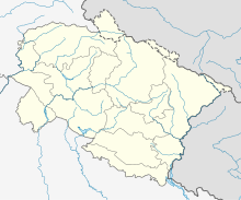
| Map | |||||||||||
 | |||||||||||
| Runways | |||||||||||
| |||||||||||
| Statistics (April 2023 – March 2024) | |||||||||||
| |||||||||||
Pantnagar Airport (IATA: PGH, ICAO: VIPT) is a domestic airport serving Pantnagar and its adjoining regions, located in the Udham Singh Nagar district in of Uttarakhand, India. It is operated by the Airports Authority of India. It is the nearest airport to the Kumaon division and is located in the middle of Haldwani and Rudrapur, the two largest cities of Kumaon. It is 26 km from Haldwani and from the Kumaon hill stations of Nainital (65 km), Bhimtal (50 km), Ranikhet (110 km) and Almora (120 km), Bareilly (65 km) and the Jim Corbett National Park (120 km).[4][5]
- ^ "Annexure III – Passenger Data" (PDF). aai.aero. Retrieved 22 April 2024.
- ^ "Annexure II – Aircraft Movement Data" (PDF). aai.aero. Retrieved 22 April 2024.
- ^ "Annexure IV – Freight Movement Data" (PDF). aai.aero. Retrieved 22 April 2024.
- ^ "A gem in perfect setting". The Tribune. 11 May 2008. Retrieved 29 June 2009.
- ^ "Places of Tourist Interest". Archived from the original on 16 July 2009. Retrieved 29 June 2009.

