Paragonah, Utah | |
|---|---|
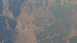
 Aerial view of the town | |
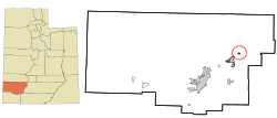
 Location in Iron County and the state of Utah | |
| Coordinates: 37°53′8″N 112°46′27″W / 37.88556°N 112.77417°W | |
| Country | United States |
| State | Utah |
| County | Iron |
| Founded | 1851 |
| Incorporated | April 3, 1916 |
| Named for | Southern Paiute for the Little Salt Lake |
| Area | |
| • Total | 0.67 sq mi (1.74 km2) |
| • Land | 0.67 sq mi (1.74 km2) |
| • Water | 0.00 sq mi (0.00 km2) |
| Elevation | 5,879 ft (1,792 m) |
| Population (2010) | |
| • Total | 488 |
| • Estimate (2019)[2] | 545 |
| • Density | 809.81/sq mi (312.53/km2) |
| Time zone | UTC-7 (Mountain (MST)) |
| • Summer (DST) | UTC-6 (MDT) |
| ZIP code | 84760 |
| Area code | 435 |
| FIPS code | 49-57960[3] |
| GNIS feature ID | 1431094[4] |
Paragonah (/ˌpærəˈɡuːnə/ PARR-ə-GOO-nə) is a town in Iron County, Utah, United States. The population was 488 at the 2010 census.[5]
- ^ "2019 U.S. Gazetteer Files". United States Census Bureau. Retrieved August 7, 2020.
- ^ Cite error: The named reference
USCensusEst2019CenPopScriptOnlyDirtyFixDoNotUsewas invoked but never defined (see the help page). - ^ "U.S. Census website". United States Census Bureau. Retrieved January 31, 2008.
- ^ "US Board on Geographic Names". United States Geological Survey. October 25, 2007. Retrieved January 31, 2008.
- ^ "Geographic Identifiers: 2010 Census Summary File 1 (G001): Paragonah town, Utah". American Factfinder. U.S. Census Bureau. Archived from the original on February 13, 2020. Retrieved April 13, 2018.