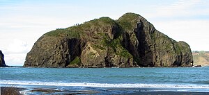
Native name: Motu Paratūtai | |
|---|---|
 | |
 | |
| Geography | |
| Location | Auckland |
| Coordinates | 37°02′46″S 174°30′29″E / 37.046°S 174.508°E |
| Adjacent to | Manukau Harbour, Tasman Sea |
| Highest elevation | 13 m (43 ft) |
| Administration | |
New Zealand | |

Paratutae Island, also known as Paratūtai Island, is an island off New Zealand at the mouth of the Manukau Harbour, at Whatipu in the Waitākere Ranges area.