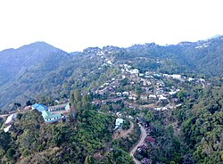
Parbung
Bungkhawpui | |
|---|---|
Village | |
 Parbung Village | |
| Coordinates: 24°14′56″N 93°06′23″E / 24.24897°N 93.10636°E | |
| Country | |
| State | Manipur |
| District | Pherzawl District..[1] |
| Population (2011) | |
| • Total | 2,545[2] |
| Languages | |
| • Official | Hmar |
| Time zone | UTC+5:30 (IST) |
| Vehicle registration | MN |
Parbung is a Hmar village in Pherzawl District, Manipur and is the headquarters of the Tipaimukh Sub-Division.[3][4] Prior to 2017, it used to be the headquarters of the larger Tipaimukh Sub-Division,[5] It is also the center of a district council constituency of the Churachandpur Autonomous District Council.[6][7]
- ^ "Villages | Pherzawl District | India".
- ^ "Village and Town Directory", District Census Handbook, Churachandpur. Directorate of Census Operations, Manipur. 2011. p. 86.
- ^ "Villages | Pherzawl District | India".
- ^ "Administrative Setup | Pherzawl District | India".
- ^ District Census Handbook, Churachandpur. Directorate of Census Operations, Manipur. 2011. p. 20.
- ^ "Autonomous District Council | Churachandpur District, Government of Manipur | India".
- ^ "Demography | Pherzawl District | India".

